












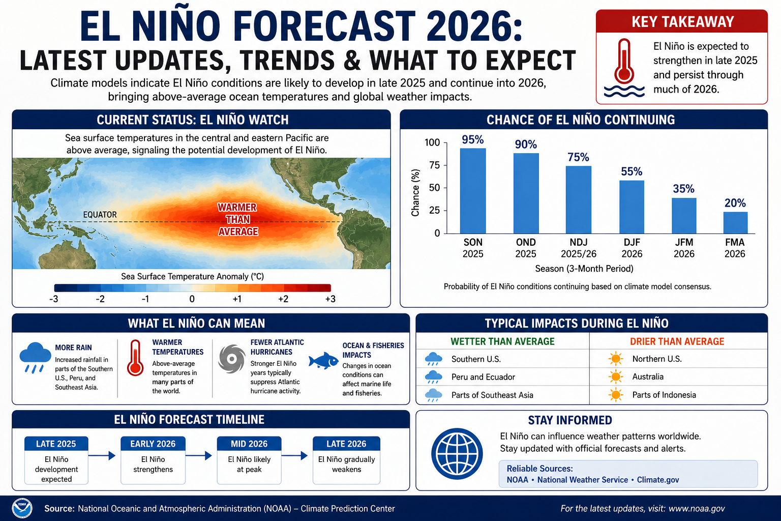
El Niño conditions are active in 2026 and expected to strengthen through the rest of the year, according to NOAA’s Climate Prediction Center.

Current ENSO Status
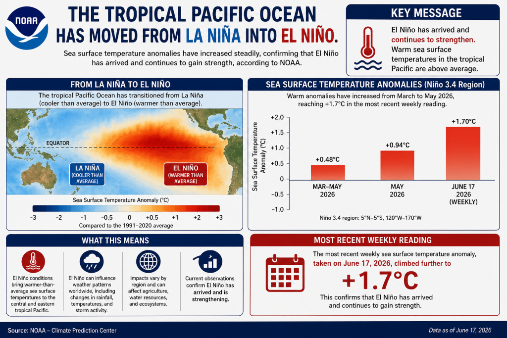
The tropical Pacific Ocean has moved from La Niña into El Niño. Sea surface temperature anomalies reached +0.48°C during March to May 2026 and rose to +0.94°C in May 2026. The most recent weekly reading, taken on June 17, 2026, climbed further to +1.7°C. This confirms that El Niño has arrived and continues to gain strength, according to the IRI ENSO Forecast. IRIIRI
How Strong Will It Get
Forecasters expect this El Niño to keep building through the summer and into winter. NOAA’s official outlook shows a 96% chance that El Niño will continue through December 2026 to February 2027. Some forecasters are calling this a possible “super El Niño.” The Climate Prediction Center puts the odds of the event reaching strong or very strong intensity by October at roughly 65%, with close to equal chances of a very strong, strong, or moderate event peaking between November 2026 and January 2027. Full technical details are published by the Climate Prediction Center. NOAA Climate Prediction CenterStormBag
What The Models Show
Multiple independent forecasting systems agree on this trend. The North American Multi-Model Ensemble, NOAA’s CFSv2, and the European Centre for Medium-Range Weather Forecasts all point to El Niño development by mid-summer, with the median European model reaching close to +3°C in the Niño 3.4 region by autumn. A few individual model runs go even higher. This level of agreement across separate models adds confidence to the forecast, according to Stormbag. StormBag
Understanding The Numbers
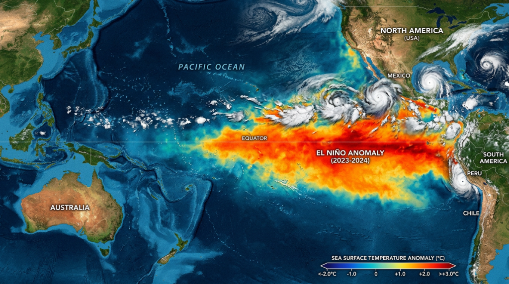
El Niño strength is measured using ocean temperature in a specific part of the Pacific. A “very strong” event, sometimes called a super El Niño, requires sustained temperature anomalies of +2.0°C or higher in the Niño 3.4 region. Here is a simple breakdown of what these categories mean. StormBag
| El Niño Strength | Niño 3.4 Anomaly |
|---|---|
| Weak | +0.5°C to +0.9°C |
| Moderate | +1.0°C to +1.4°C |
| Strong | +1.5°C to +1.9°C |
| Very Strong (Super) | +2.0°C or higher |
Signs Pointing To A Strong Event
Ocean conditions below the surface also support the forecast for a powerful El Niño. A large downwelling Kelvin wave is moving east across the equatorial Pacific, with subsurface temperature anomalies of up to +8°C between roughly 50 and 250 meters deep. As this warm water rises to the surface in the coming months, it is expected to add more heat to the ocean surface. This subsurface signal is tracked closely by the Climate Prediction Center. StormBag
What El Niño Means For Weather
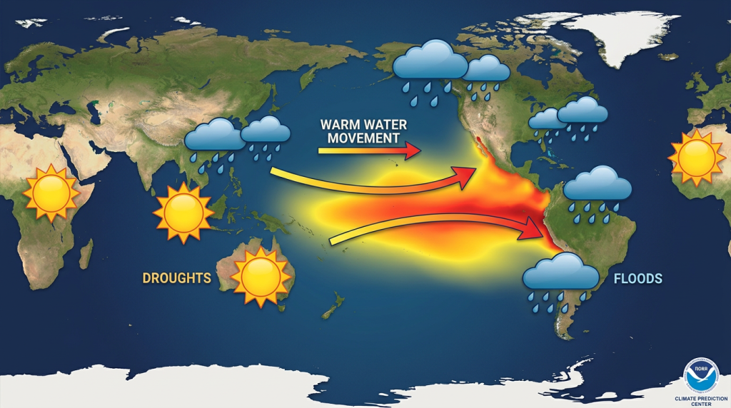
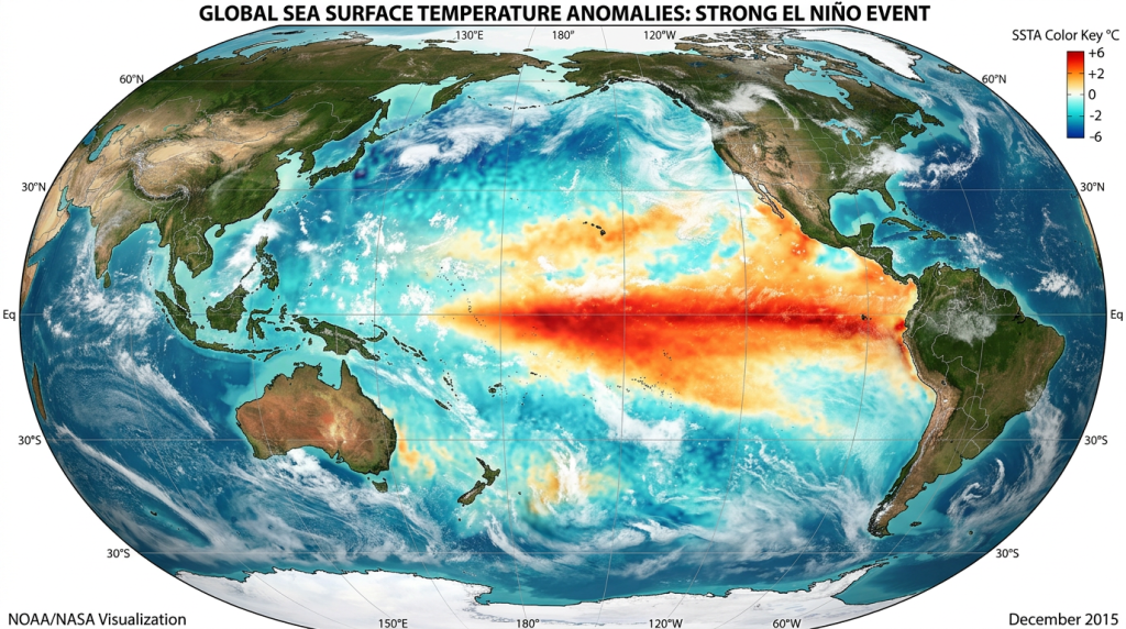
El Niño changes global weather patterns in predictable ways. Warming ocean surface temperatures in the central and eastern tropical Pacific reduce rainfall over Indonesia while increasing rainfall over the central and eastern Pacific. The easterly winds that normally blow along the equator weaken or can even reverse direction during an El Niño event. These shifts affect temperature and rainfall patterns across many countries, as explained by the National Weather Service. National Weather ServiceNational Weather Service
A Warmer Baseline Than Past Events
This El Niño is developing under different background conditions than earlier events. The 2026 to 2027 El Niño is forming on top of a global warming baseline of roughly 1.3°C, which can change how the event interacts with land temperatures, atmospheric moisture, and extreme rainfall patterns. This makes historical comparisons useful but not exact, according to Stormbag. StormBag
What To Watch Next
Forecasters are tracking a few key signals in the coming weeks. A sustained move in the weekly Niño 3.4 anomaly above +1.0°C would push the forecast firmly toward a moderate to strong event, and continued warm water spreading eastward below the surface would reinforce the surface warming trend. The next official ENSO Diagnostic Discussion from NOAA is scheduled for June 11, 2026. Updates are released monthly through the Climate Prediction Center. StormBagNOAA Climate Prediction Center